This is how aquatic drones are supporting water management
Fresh water systems are rapidly changing and water quality is deteriorating as a result of climate change. Aquatic drones can help us understand these changes – which will be key to tackling water-related challenges ahead.
C
limate change and increasing fallout from human activities are accelerating physical and chemical changes in water systems around the globe.
The intensification of extreme weather events and changing weather patterns may significantly affect the normal balances of water cycles and biodiversity in different regions, which in turn leads to an increasing deterioration of water quality and accentuates water scarcity. This has consequences not only at environmental and ecosystem level, but also at social and economic levels, particularly in regions where water resources are already under a lot of pressure and demand.
To keep up with these trends, there is an urgent need for monitoring methods to provide up-to-date and detailed data, which can be used to validate hydrological models and support water management and climate adaptation actions.
The environmental condition of surface water is traditionally based on isolated ‘single point’ measurements, without taking into account the spatial and temporal variability of water quality and ecology. The collection of data using mobile platforms (underwater drones, boats, or unmanned surface vehicles) is gradually becoming more common, with new applications and uses being explored every day.
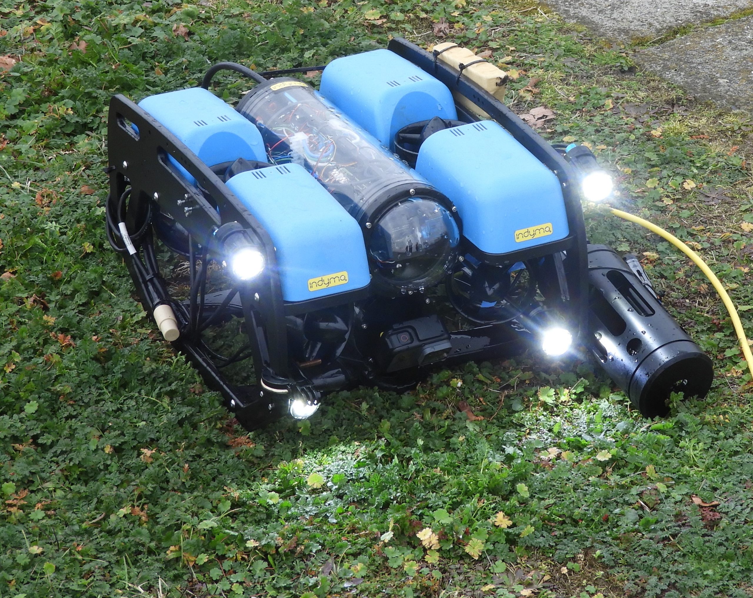
Collecting data in new ways – a drone up close. Photo courtesy Rui Lima
Local challenges
The success of different monitoring methods and tools depends on socio-economic contexts alongside water-related challenges. In Europe, for example, legislations such as the Water Framework Directive classify and assess surface water systems based on strict standard values and indicators. The proliferation of blue-green algae (cyanobacteria) are currently one of the most relevant ecological problems related with climate change. These toxic algae affect recreation areas by producing unpleasant smells and toxins that can poison humans and animals, including fish, ducks, or dogs. Contamination events usually take place during summer months, and their frequency is increasing with higher temperatures and longer dry periods associated with climate change. Traditional point sampling monitoring of water quality and algae is expensive, labor-intensive and provides only limited information about the spatial distribution of concentrations. Results of tests are only available after a few days or weeks. Recently, handheld sensors are allowing water authorities to quicken their surveying and alarm systems.
Meanwhile, many developing countries struggle with deteriorating water quality due to very inefficient or inexistent solid waste management infrastructure – high population growth and the lack of sewage and purification systems for households and industry. Climate change accentuates most of these issues and adds uncertainties. Environmental regulations and environmental monitoring programmes are usually scarce and overlooked. Water managers are concerned with identifying pollution sources or illegal discharges of (industrial) wastewater, but often lack suitable monitoring tools and legal support to address these issues. The lack of awareness of the population for the preservation of water quality and hydrological cycle – and consequent lack of basic principles – is a major obstacle to improvement of water resources in these regions.
Monitoring with aquatic drones
Field monitoring campaigns using aquatic drones equipped with novel sensors collected environmental data around the globe – from the Netherlands, Denmark, Indonesia and Vietnam, to Peru and Mali. These quick scans of surface water bodies resulted in 3D and 2D spatial mapping of water quality parameters, including the visualization of the stratification/variation with depth.
This method also gave insight into underwater life from footage taken while submerged. Locations were strategically selected to include different parts of water systems – such as reservoirs/dams, upstream/downstream of industry and urban areas. Measured parameters included turbidity, electrical conductivity, dissolved oxygen or nutrients (ammonium/nitrate).
Other methods were also used, such as vertical profiling from boats/bridges, use of test strips combined with smartphone apps and static continuous measurement sensors in strategically-selected outlets. The methodology aims at reducing monitoring costs, while increasing data resolution.
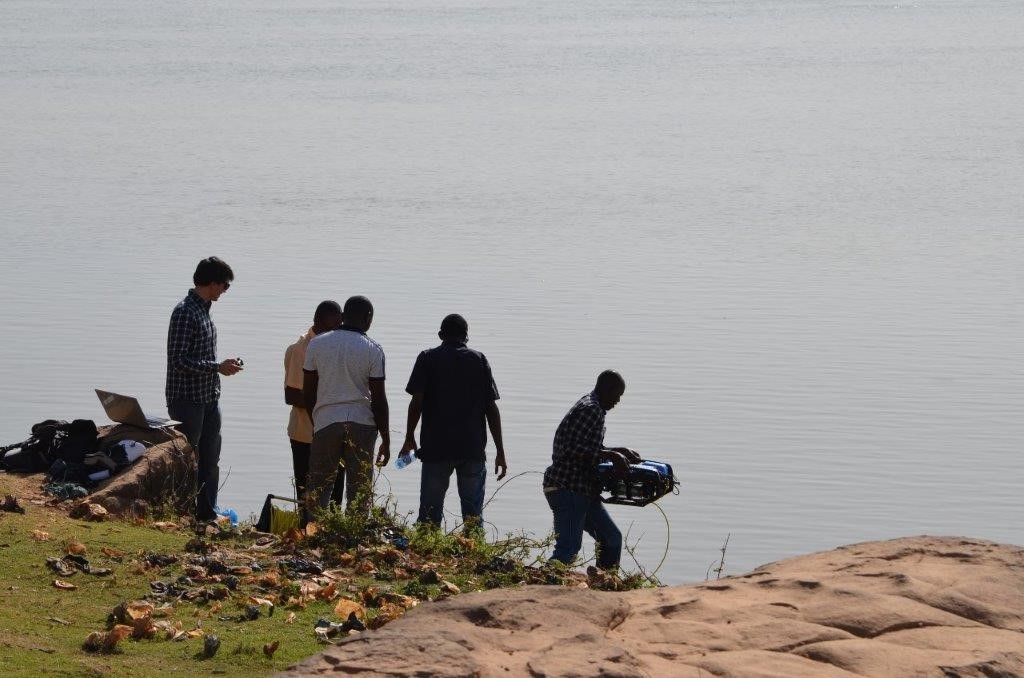
Fieldwork activities conducted with local water managers and students. Photo courtesy Floris Boogaard
Water quality data and results
Results gave an indication of concentration values of basic water quality parameters. Areas with higher concentrations of negative indicators could be identified, with potential pollution sources tracked. Underwater images meanwhile allowed insights into aquatic fauna, flora and benthic environments. The data furthered understanding of the water systems, and helped making recommendations for water management interventions and actions.
In addition, the work showed how local water managers and stakeholders can use new technologies that drive data quality and quantity, and use this information to design and plan climate adaptation measures. Autonomous collection of data, real-time access to datasets and quick response triggered by events, were highlighted as top needs by local water managers.
Valuable data
Aquatic drones contribute to a better understanding of local water resources (water, ecology, sediment) and factors that affect them. Data collected is now being used by local authorities to design monitoring plans that contemplate adaptation measures to climate change.
Although further research is needed, valuable information about the behavior of water systems and their variability has been acquired. There is no doubt now that aquatic drones show potential as a cost-efficient monitoring solution and a valuable source of data (for validating predictive models).
Moreover, the drones can be used to raise awareness or serve educational purposes by training stakeholders and water managers. Local people and students were also engaged during the measurements, with many interested in learning more about the monitoring and results.
The ideas presented in this article aim to inspire adaptation action – they are the views of the author and do not necessarily reflect those of the Global Center on Adaptation.
